


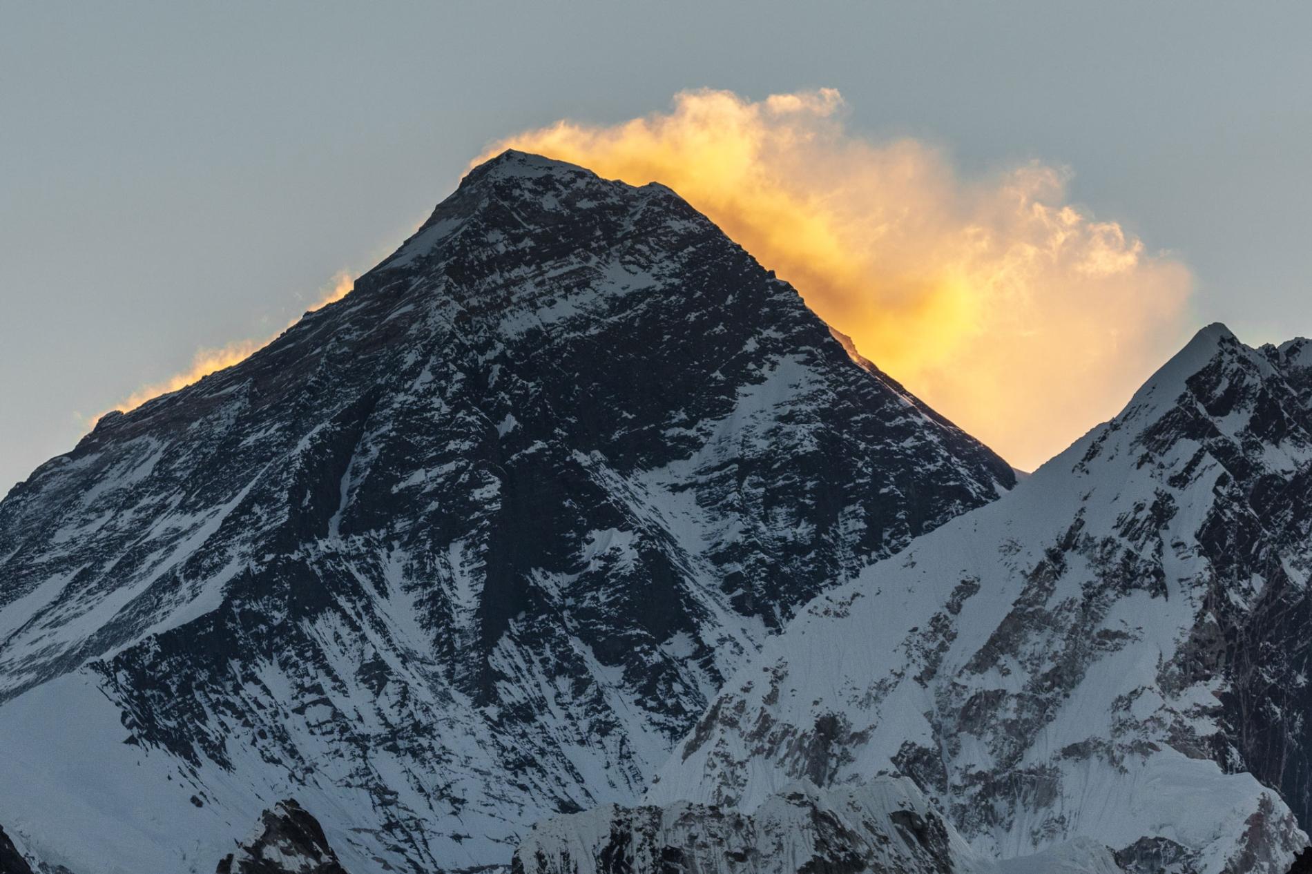
Everest Keep changing its height


The highest point on Earth has a newly announced elevation. Mount Everest is 29,031.69 feet above sea level, according to survey results presented today. That is more than two feet higher than the altitude previously recognized by the government of Nepal.
The elevation, which was announced on December 8 in a joint statement by the Survey Department of Nepal and Chinese authorities, is the culmination of a multiyear project to definitively measure the legendary mountain. As the first serious survey of Everest in 16 years, the effort has been closely followed by the geographic community—particularly scientists analyzing how a devastating 7.8 magnitude earthquake in 2015 affected the region.
Last spring a small group of Nepalese surveyors and guides endured the biting cold of a nighttime ascent, reaching the top at 3 a.m. local time so they could conduct their work unimpeded by crowds of recreational climbers, to try to settle the matter.
“We want to deliver the message that we can do something with our own [country’s] resources and technical manpower,” Khimlal Gautam, chief survey officer for the project, told National Geographic last year.
Technological peaks
In 1856, mathematician Radhanath Sickdhar found that Everest is the highest mountain in the world while he was working for the Great Trigonometrical Survey, a project dedicated to surveying and mapping the Indian subcontinent. Since then, a handful of surveys have sought to pin down the mountain’s true height with the best technology available at the time.
Until the advent of satellites, surveyors used a device called a theodolite, a precision optical instrument mounted on a tripod, for measuring angles between two designated points. Lugging their heavy equipment from hilltop to hilltop, a survey team would incrementally measure Everest’s height from sea level, zig-zagging north from the Bay of Bengal until they could see the peak.
A 1954 survey using a similar technique calculated that Everest stands at 29,028 feet above sea level, a number that is still recognized by many countries and map publishers.


Then in 1999 a survey led by cartographer and explorer Bradford Washburn, and sponsored by the National Geographic Society, was the first to use GPS technology to measure the Everest summit. That team’s work delivered an altitude of 29,035—the figure still in use by the Society until the new measurements can be fully verified.
Mounting excitement
To make their new survey as complete as possible, the Nepalese team decided to employ both techniques. On May 22, 2019, Gautam summited Everest with four teammates and deployed a GPS receiver, along with ground-penetrating radar to measure the depth of the snow piled on top of the rock. Meanwhile, teams of surveyors waited at eight sites with views of Everest’s summit to fix its elevation at sunrise, when the atmosphere is most clear, with modern laser theodolites.
But after the Survey Department of Nepal completed its field work last year, the project became mired in international politics. During Chinese President Xi Jinping’s state visit to Nepal in October 2019, officials announced that the two countries would cooperate in re-surveying the mountain, delaying the revelation of the new height. A team of Chinese surveyors were at work on the north side of the mountain this spring measuring the summit using China’s network of Beidou satellites, a rival to the GPS system.
Now that the results have been announced, representatives from both countries expressed extreme confidence in the new altitudes. But Gautam is quick to point out that no matter how accurate, every survey comes with some margin for error. “In survey mapping, we can’t find the exact point or altitude,” he says. “We’re trying to find the MPV: most probable value.
Source: National Geographic
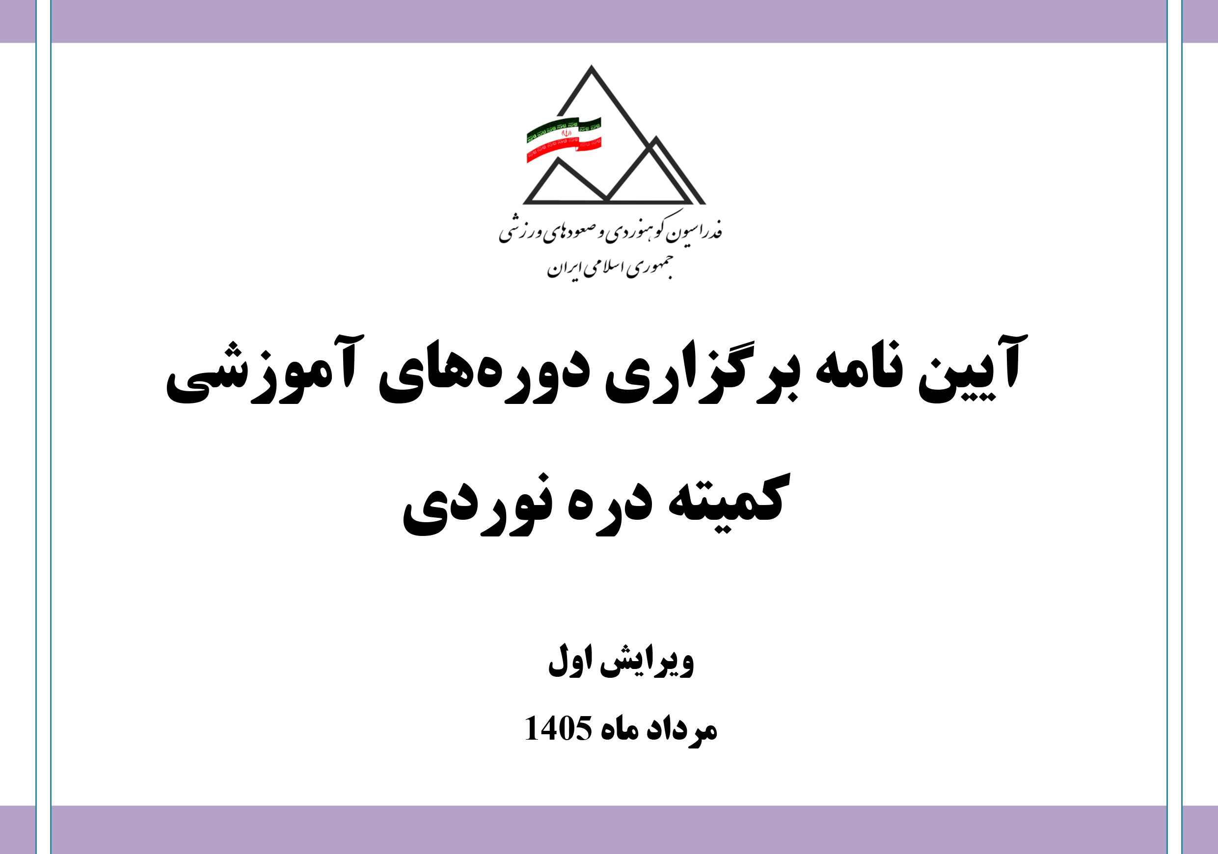
در ادامه فایل پیوست را دریافت و ملاحظه نمائید: ...

به آگاهی میرساند کمیته آموزش فدراسیون کوهنوردی و صعودهای ورزشی در راستای اجرای برنامه عملیاتی سال 1405 و به منظور توسعه کمی و کیفی و ارتقاء آموزش در سطح کشور و جذب نیروی متخصص با توجه به نیازهای آموزشی، در نظر دارد آزمون ورودی مربیگری درجه ۲ سنگنوردی در بخش آقایان و بانوان ویژه کسانی که رزومه و مستندات صعود را ارسال کردند (اسامی زیر) را به شرح زیر برگزار نماید:..

به آگاهی می رساند؛ کمیته آموزش فدراسیون کوهنوردی و صعودهای ورزشی در راستای اجرای برنامه عملیاتی سال 1405 و به منظور توسعه کمی و کیفی و ارتقاء آموزش در سطح کشور و جذب نیروی متخصص با توجه به نیازهای آموزشی، در نظر دارد آزمون ورودی مربیگری درجه ۳ سنگنوردی در بخش آقایان- بانوان ویژه کسانی که نسبت به ارسال رزومه و مستندات صعود اقدام کردند (لیست پیوست) به شرح زیر برگزار نماید :...

پیرو دریافت دعوتنامه از فدراسیون سنگنوردی اندونزی برای حضور در جشنواره بینالمللی سنگنوردی هارائو (HICFEST 2026)، این رویداد از تاریخ ۱۲ تا ۱۶ آبانماه ۱۴۰۵ (برابر با ۳ تا ۷ نوامبر ۲۰۲۶) در کشور اندونزی برگزار خواهد شد.
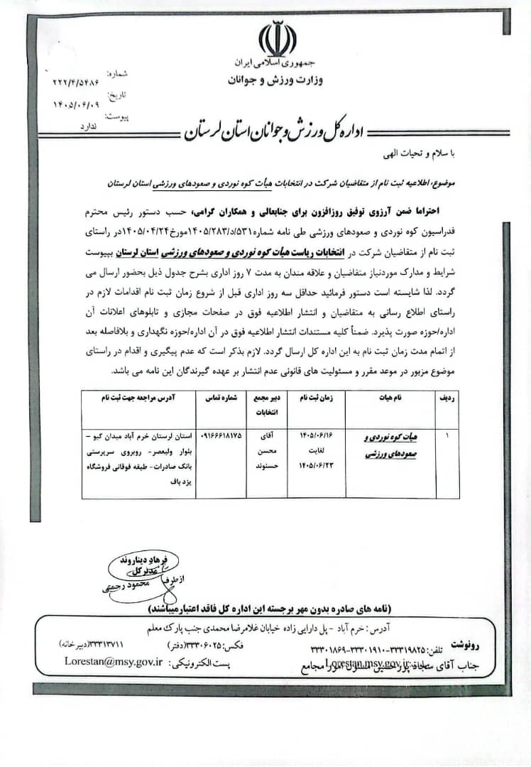
تصویر پیوست را در ادامه دریافت و ملاحظه نمائید: ...
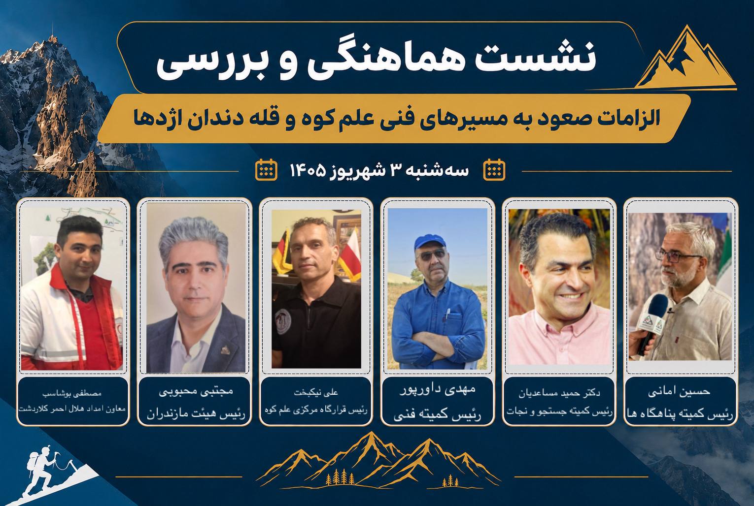
ادامه مطلب را ملاحظه نمائید:…
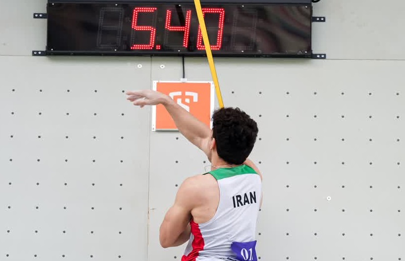
گزارش تصویری / صعود «رضا علیپور» از مرحله مقدماتی در «چالش جهانی سنگنوردی شانگهای»
پایان چالش جهانی سنگنوردی شانگهای ۲۰۲۶؛ قهرمانی «لینگ» از «چین» در ماده «سرعت»
برگزاری مسابقات سنگنوردی قهرمانی استان خراسان شمالی در بجنورد
دعوت به شرکت در جشنواره بینالمللی سنگنوردی هارائو (HICFEST 2026) – اندونزی
پيش بيني شرايط جوی مناطق كوهستاني كشور(۱۲ و ۱۳ شهریور ١٤٠٥)
آزمون ورودی مربیگری درجه ۳ سنگنوردی-خراسان رضوی -اراک مختص نفرات مجاز جهت شرکت در دوره آقایان و بانوان
آزمون ورودی مربیگری درجه 2 سنگنوردی خراسان رضوی ـ شهریور 1405 ـ آقایان و بانوان (ویژه اسامی اعلام شده در بخشنامه)
آییننامه کمیته درهنوردی - ویرایش اول - مرداد 1405
برگزاری نشست مشترک رؤسای هیئتهای تابعه و مسئولان کمیتههای هیئت کوهنوردی و صعودهای ورزشی استان البرز / ۹ شهریورماه ۱۴۰۵ + عکس
برگزاری نشست رؤسا و سرپرستان هیئتهای کوهنوردی و صعودهای ورزشی شهرستانهای خراسان رضوی در کاشمر / دوم شهریورماه ۱۴۰۵ + عکس
آییننامه کمیته درهنوردی - ویرایش اول - مرداد 1405
آزمون ورودی مربیگری درجه 2 سنگنوردی خراسان رضوی ـ شهریور 1405 ـ آقایان و بانوان (ویژه اسامی اعلام شده در بخشنامه)
آزمون ورودی مربیگری درجه ۳ سنگنوردی-خراسان رضوی -اراک مختص نفرات مجاز جهت شرکت در دوره آقایان و بانوان
دعوت به شرکت در جشنواره بینالمللی سنگنوردی هارائو (HICFEST 2026) – اندونزی
اطلاعیه انتخابات رئیس هیئت کوهنوردی و صعودهای ورزشی استان لرستان
تأکید بر رعایت الزامات صعود به مسیرهای فنی منطقه علمکوه، بهویژه دندان اژدها و گرده آلمانها
اعلام نتایج دوره مربیگری درجه 3 برف و یخ ـ حصارچال ـ 14 تا 18 مرداد 1405 / قسمت اول – کارگاه برف
مصوبه شورای عالی انقلاب فرهنگی در حمایت از ادامه تحصیل قهرمانان ورزشی
اطلاعیه ممنوعیت صعود به قله علمکوه از مسیر گرده آلمانها
دوره مانیتورینگ پیشرفته تمرین
آییننامه کمیته درهنوردی - ویرایش اول - مرداد 1405
آزمون ورودی مربیگری درجه 2 سنگنوردی خراسان رضوی ـ شهریور 1405 ـ آقایان و بانوان (ویژه اسامی اعلام شده در بخشنامه)
آزمون ورودی مربیگری درجه ۳ سنگنوردی-خراسان رضوی -اراک مختص نفرات مجاز جهت شرکت در دوره آقایان و بانوان
دعوت به شرکت در جشنواره بینالمللی سنگنوردی هارائو (HICFEST 2026) – اندونزی
اطلاعیه انتخابات رئیس هیئت کوهنوردی و صعودهای ورزشی استان لرستان
تأکید بر رعایت الزامات صعود به مسیرهای فنی منطقه علمکوه، بهویژه دندان اژدها و گرده آلمانها
اعلام نتایج دوره مربیگری درجه 3 برف و یخ ـ حصارچال ـ 14 تا 18 مرداد 1405 / قسمت اول – کارگاه برف
مصوبه شورای عالی انقلاب فرهنگی در حمایت از ادامه تحصیل قهرمانان ورزشی
اطلاعیه ممنوعیت صعود به قله علمکوه از مسیر گرده آلمانها
دوره مانیتورینگ پیشرفته تمرین
گزارش تصویری / صعود «رضا علیپور» از مرحله مقدماتی در «چالش جهانی سنگنوردی شانگهای»
پایان چالش جهانی سنگنوردی شانگهای ۲۰۲۶؛ قهرمانی «لینگ» از «چین» در ماده «سرعت»
برگزاری مسابقات سنگنوردی قهرمانی استان خراسان شمالی در بجنورد
دعوت به شرکت در جشنواره بینالمللی سنگنوردی هارائو (HICFEST 2026) – اندونزی
پيش بيني شرايط جوی مناطق كوهستاني كشور(۱۲ و ۱۳ شهریور ١٤٠٥)
آزمون ورودی مربیگری درجه ۳ سنگنوردی-خراسان رضوی -اراک مختص نفرات مجاز جهت شرکت در دوره آقایان و بانوان
آزمون ورودی مربیگری درجه 2 سنگنوردی خراسان رضوی ـ شهریور 1405 ـ آقایان و بانوان (ویژه اسامی اعلام شده در بخشنامه)
آییننامه کمیته درهنوردی - ویرایش اول - مرداد 1405
برگزاری نشست مشترک رؤسای هیئتهای تابعه و مسئولان کمیتههای هیئت کوهنوردی و صعودهای ورزشی استان البرز / ۹ شهریورماه ۱۴۰۵ + عکس
برگزاری نشست رؤسا و سرپرستان هیئتهای کوهنوردی و صعودهای ورزشی شهرستانهای خراسان رضوی در کاشمر / دوم شهریورماه ۱۴۰۵ + عکس

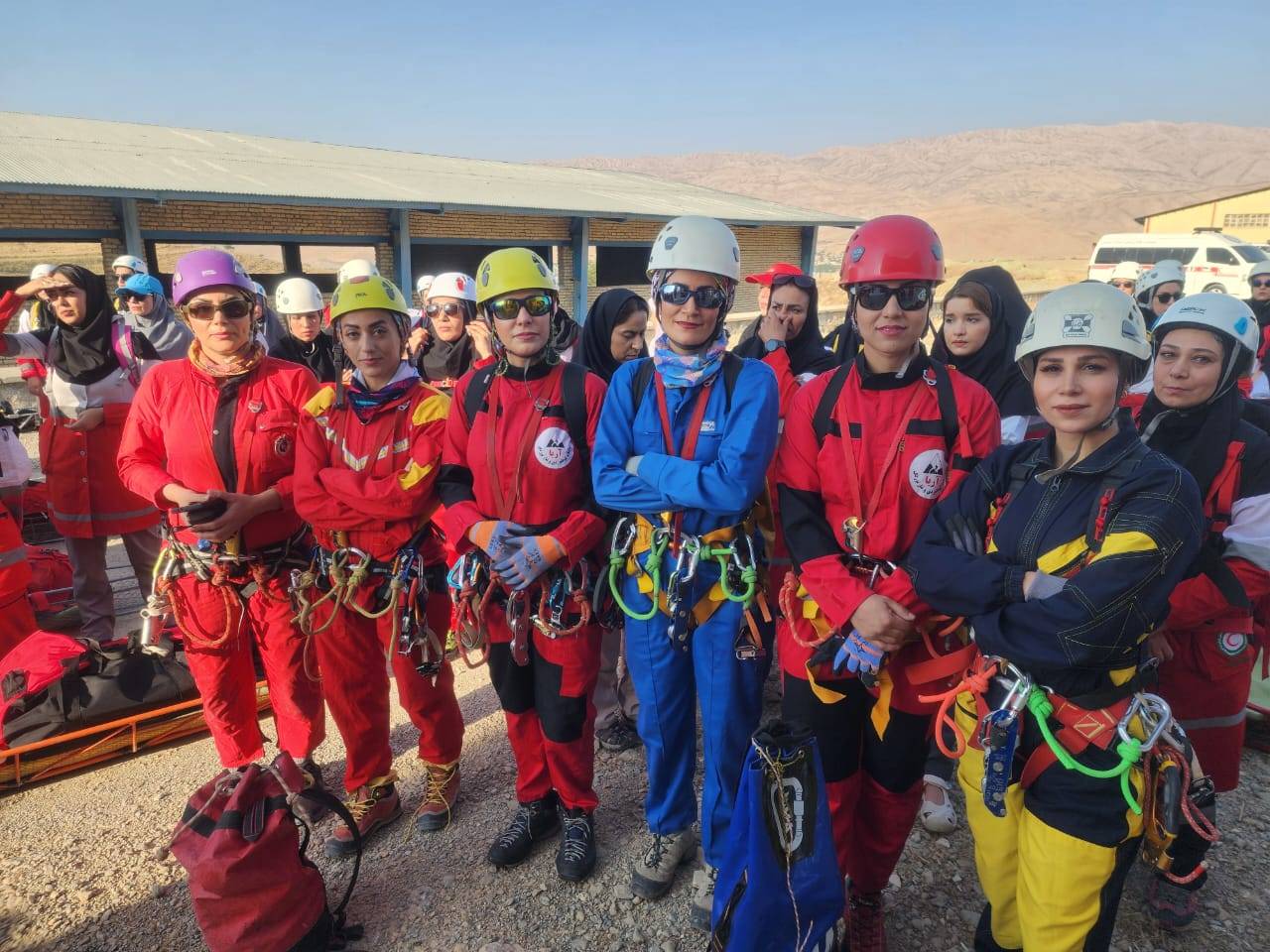
گزارش تصویری / برگزاری برنامه عملیاتی مشترک کمیته غارنوردی و غارشناسی فدراسیون و سازمان امداد و نجات هلال احمر
اطلاعیه مراسم شادروان «چنگیز شیخلی» پدر غارشناسی و غارنوردی ایران
اعطای احکام مسئولان جدید بخشهای کمیته غارنوردی و غارشناسی / تقدیر از «آرمان صفری»
تقدیر از عوامل برگزاری اردوی سراسری غارنوردی کشور سال ۱۴۰۴ برگزار شد + عکس

گزارش تصویری / برگزاری برنامه عملیاتی مشترک کمیته غارنوردی و غارشناسی فدراسیون و سازمان امداد و نجات هلال احمر
اطلاعیه مراسم شادروان «چنگیز شیخلی» پدر غارشناسی و غارنوردی ایران
اعطای احکام مسئولان جدید بخشهای کمیته غارنوردی و غارشناسی / تقدیر از «آرمان صفری»
تقدیر از عوامل برگزاری اردوی سراسری غارنوردی کشور سال ۱۴۰۴ برگزار شد + عکس